


Shelf Road Geo-hike
An easy hiking route with interesting geology near Ojai, California

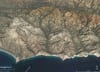
A 3.6 mile round-trip Geo-hike along Shelf Road Ojai, southern California. Route has minimal elevation gain and along a gated dirt road with no vehicle traffic, some mountain bikes. It’s a very safe and suitable route for K-12 nature and science field trips. Our Geo-hike starts at the trailhead parking area along Gridley Road and is an in-and-out hike with the same return route. North Signal Street is the turn around point. Stronger hikers may want to add on the Fox Canyon/Luci Trail Loop on the return part of the hike, that adds about 1.5 miles and 700-800 ft elevation gain.
Shelf Road Geo-hike is within the Ojai Valley Land Conservancy property, https://ovlc.org/explore. OVLC does a great job with land management, preservation, and education. Please abide by their regulations and consider a donation.
Safety: Be on the look-out for rattlesnakes while hiking: watch where you step, and don't reach out or sit down without looking first. Snakes are commonly out in the early morning and evening if the weather is mild or warm, and then, just about any time of year.
Here’s a short video that summaries some of the geology along Shelf Road.
Geology: Shelf Road follows outcrops of the uppermost portion of the Eocene-age Coldwater Formation*. In a few places the road cross the contact with the younger Oligocene-age and reddish-color Sespe Formation**. Shelf Road is within a map-scale structure called the Matilija overturn that is due to folding above the San Cayetano thrust fault***. The fault tip lies just below the earth's surface. That is the fault does not reach the surface in this area and is referred to as a “blind thrust”. Further east, along the north side of upper Ojai Valley the fault does reach surface and continues eastward at the surface for 10s of miles. The overturn is a band of rock layers where the stratigraphic order has been reversed and older strata lie above younger strata. This is due to large amounts of north-south crustal convergence (shortening) during the last several million years.
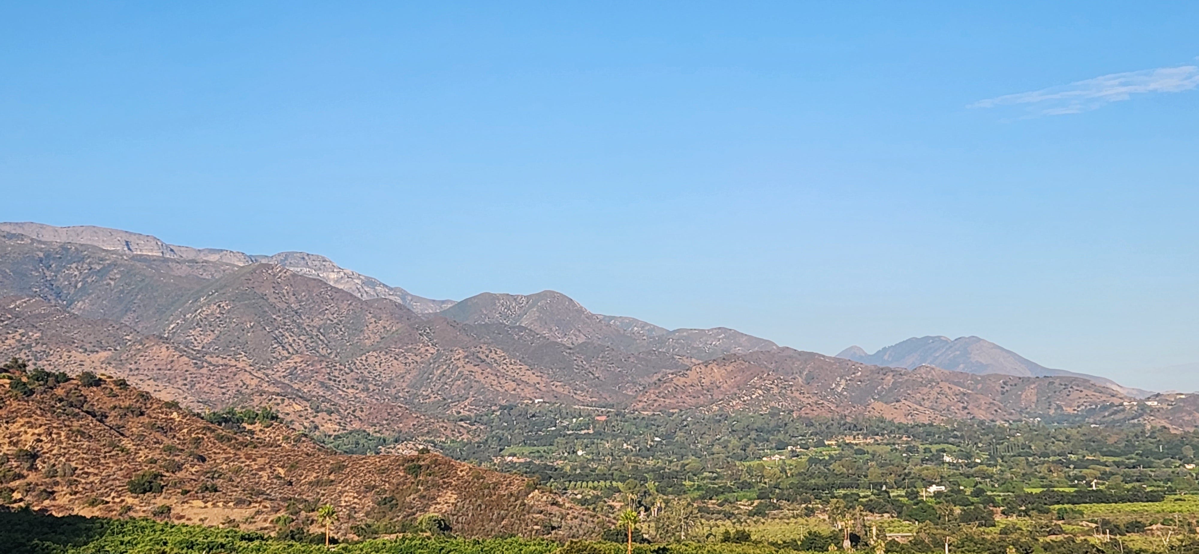
Photo: Looking east from Shelf Road near the Gridley Road trailhead. The Santa Ynez Range with the Topa Topa Ridge is on the left and eastern Ojai Valley on the right. The giant Santa Ynez anticlinorium is shown by the tilted rock layers (strata).
*Coldwater Formation (or Coldwater Sandstone): a thick, resistant to erosion, sandstone dominated with lesser amounts of siltstone and shale. Stratigraphic (relative) age of the Coldwater Formation is middle to upper Eocene and the unit has been dated from 39.5 Ma (million years ago) to 42.5 Ma in absolute terms. The Shelf Road section is probably closer to the 39.5 Ma age as it is within the uppermost portion of the formation. The Shelf Road portion was deposited in very shallow marine conditions: the wave-zone indicated by high-energy sedimentary structures such as large cross-bedding, and estuary-back-bay setting indicated by the abundance of fossil oysters fragments. More info: https://en.wikipedia.org/wiki/Coldwater_Sandstone
**Sespe Formation. More info https://en.wikipedia.org/wiki/Sespe_Formation
***San Cayetano fault. More info: https://en.wikipedia.org/wiki/San_Cayetano_Fault

Portion of cross section 6-6’ showing the crustal structure beneath Shelf Road and Ojai.

Complete cross section 6-6’ from coast to Lockwood Valley (top) and structural restoration (bottom): https://drive.google.com/file/d/1kkHkLbNX5WYTxAMMaKYS4oLoU_EK8ZSX/view
More on Geo-hikes: https://www.meetup.com/https-www-meetup-com-geo-hikes/