


Geo-hike to the SOCO Hattie Russell #1 well site along a panoramic and beautiful trail (part 1)
Steep west face of nearby Haddock Peak provides an natural cross-sectional view of the well test

The Standard Oil Company of California (SOCO) drilled the Hattie Russell #1 well on the south side of Reyes Peak. Western Transverse Ranges, California in the early 1950s. Reyes Peak lies along the antiformal Pine Mountain Ridge within the Los Padres National Forest. Peak and ridge are high enough to be blanketed in tall pines and often snow-covered in the winter. It is a rugged, pristine, Alpine-like area with great panoramas of the eastern Cuyama basin and badlands and Mount Pinos to the north, and various ridges and valleys of the western Transverse Ranges to the south. If it is clear day, it is possible to see all the northern Channel Islands. This is a very appealing area for hikers, campers, and geologists too. A short hike to the well site provides an educational stop for structural geology, geologic surface mapping, and petroleum exploration methods common in the 20th Century and still in use today.
It is about three miles roundtrip hike from the trailhead to the well site. The trailhead is at the east end of the Pine Mountain Ridge Road that is paved, except for the last half mile is dirt. The Ridge Road is about eight miles east of Highway 33 and open from mid-May through Mid-October, the rest of the year there is a locked gate at the Highway 33 turn-off, but you can hike it.
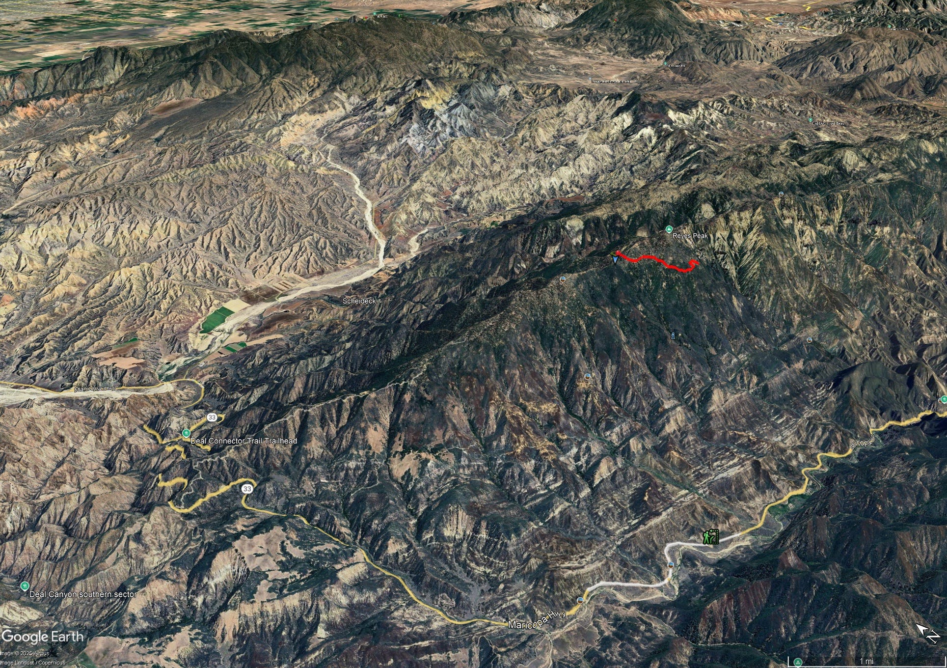
Pine Mountain Ridge, Highway 33 (yellow line), trail to SOCO Hattie Russell #1 well site (red line)
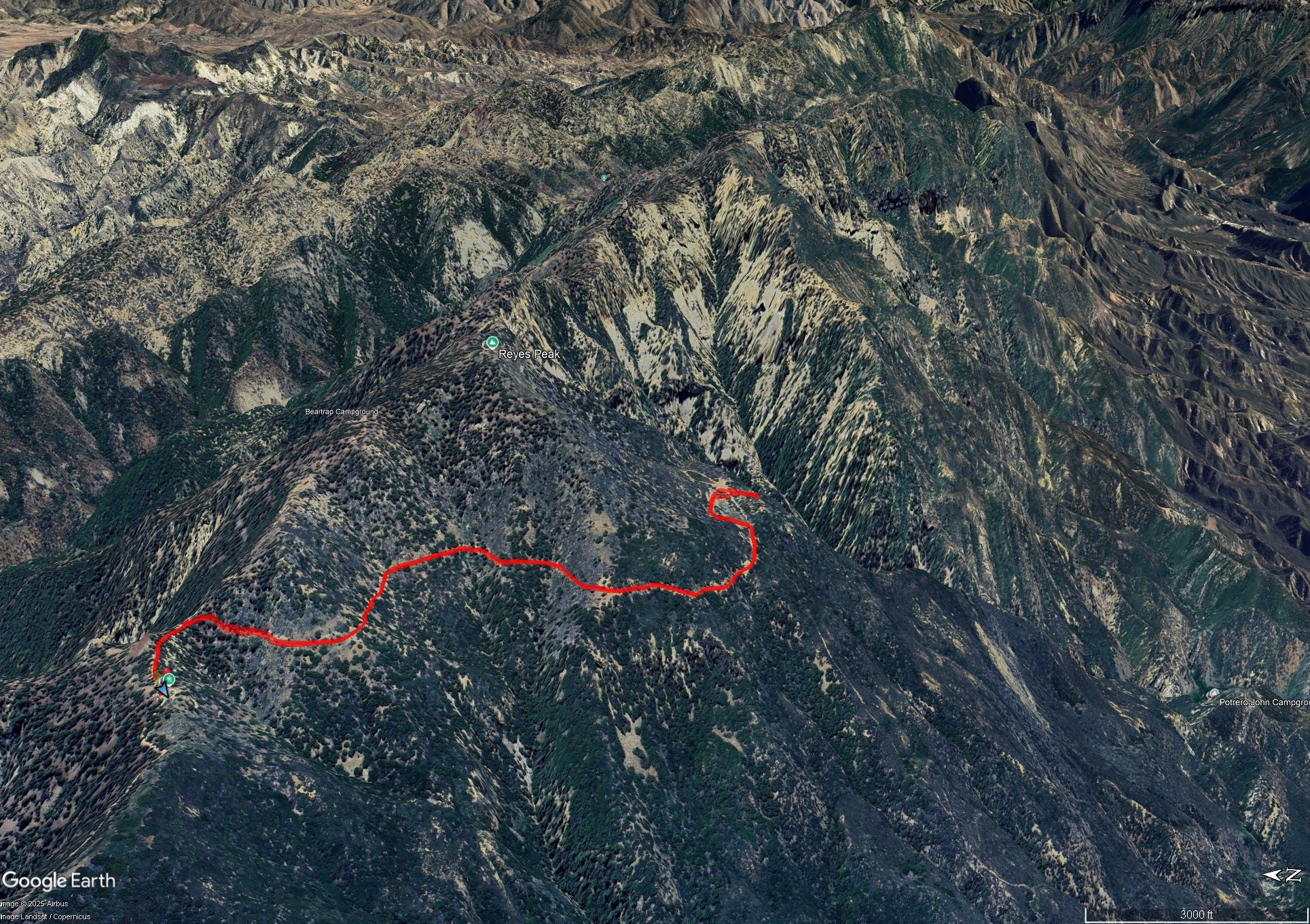
Reyes Peak and Haddock Peaks along the Pine Mountain Ridge, trail to SOCO Hattie Russell #1 well site (red line)
The well site is located some distance north of the surface mapped crest of the antiform. Hydrocarbons sometimes accumulate at the crest of an anticlinal structure if there is sealing layer to trap their upward migration. The SOCO geologists and engineers recognized that the structure was asymmetric in cross sectional view and that the crestal location will migrate northward with depth. This can be appreciated at the southern-edge of the flat area (old well pad) and looking east towards Haddock Peak. The cliffy western flank of the peak provides a natural cross section. Directly under the peak the strata can be seen dipping at low angle to the northeast. To right of the peak and downslope (south) the dips are steeper and inclined to the southwest. This indicates an anticlinal structure with its crest between the opposing dips. Since the southern limb of the antiform are steeper than the northern limb, the antiform is asymmetric to the south. It has southward vergence in more classic structural geology terms.
Video with geologic discussion: https://youtu.be/YmI2FlyPb4E?feature=shared
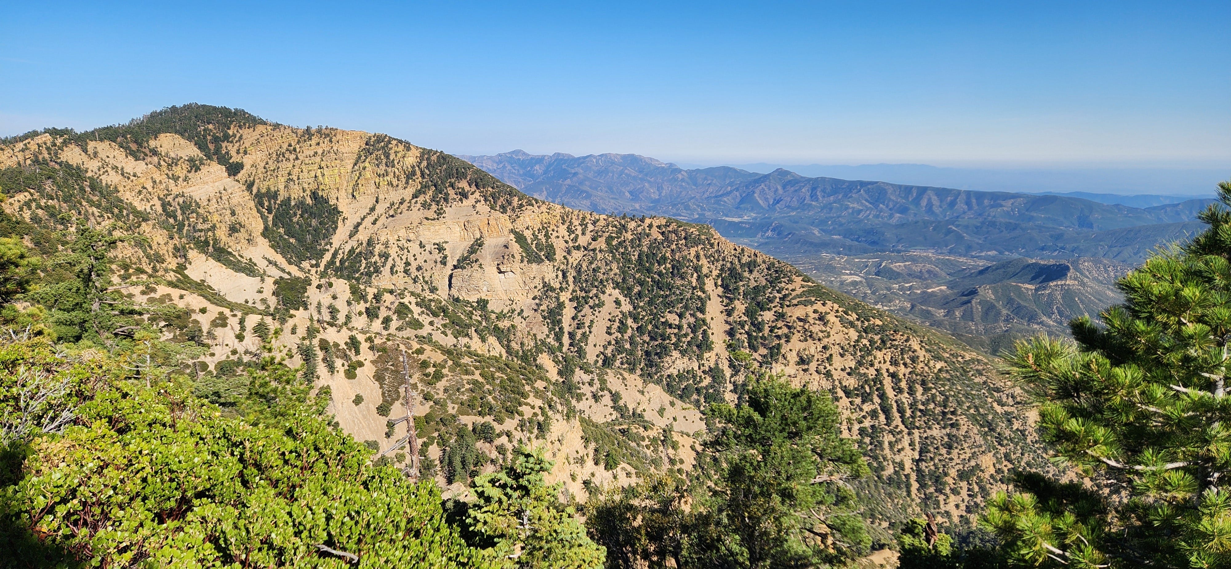
Haddock Peak, view east from side of Reyes Peak. Gentle northeast dip of Matilija Sandstone layers occur under the peak top.
Summary of the SOCO Hattie Russell #1 drilling record: At the well site there is a pipe stand with the Hattie Russell #1 plaque at the top. From the location, SOCO evaluated the oil and gas potential of the Pine Mountain Ridge antiform, a convex upward fold in the rock layers. The well spudded-in (start of drilling) in lower Matilija Sandstone (marine deposit of Eocene age) and reached the top of the Jalama Formation at 380 feet depth. From that point, only Jalama Formation was encountered in the remainder of the well that reached a total depth of 9748 feet. Well cores indicate that the rock layers encountered had a low- to moderate-dip and no major faults were crossed by the well. The Jalama consists of interbedded shale, siltstone, and sandstone (marine deposit of Eocene to possible Late Paleocene age). The test was a dry hole, several formation tests were run, but only minor and sporadic hydrocarbon indicators are recorded: kerosene-like odors, and gassy-water, and weak pale-yellow cut on rock samples using carbon tetrachloride (CCl₄). The well took 18 months to drill and had lots of drilling issues like numerous lost circulation zones, where drilling mud is lost to the surrounding rock. Several stuck drilling pipe occurrences, some resulting in abandoned pipe in the hole (junk) and side-tracks may have been the caused by lost circulation zones.
Video discussion of well site: https://youtu.be/dGk3HIwp3Yo?feature=shared
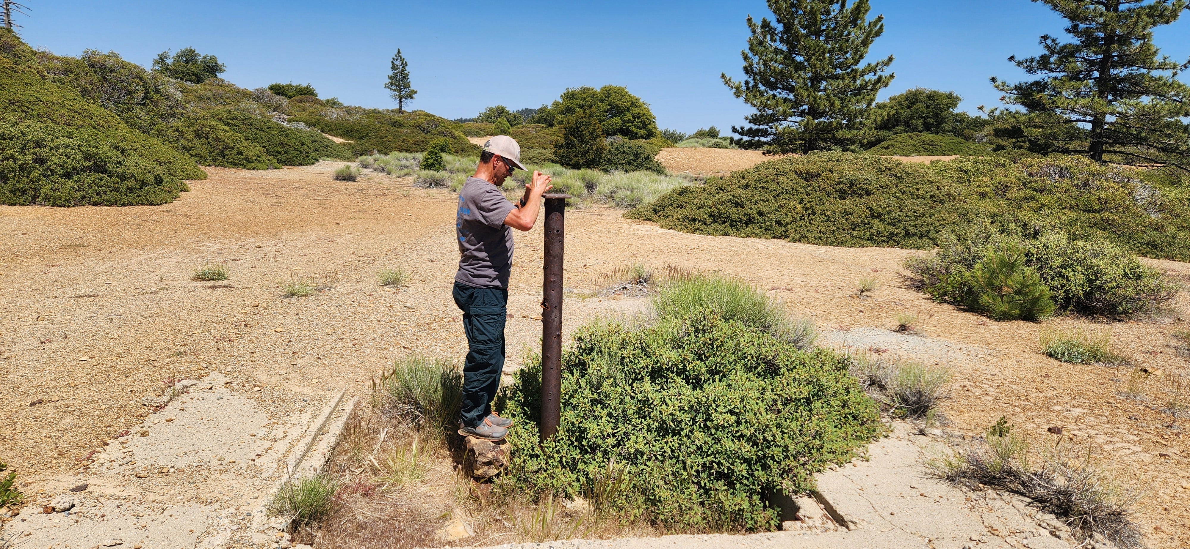
SOCO Hattie Russell #1 location with well stand and filled-in cellar. Extensive flat area was modified to make a large pad site for this remote drilling location.
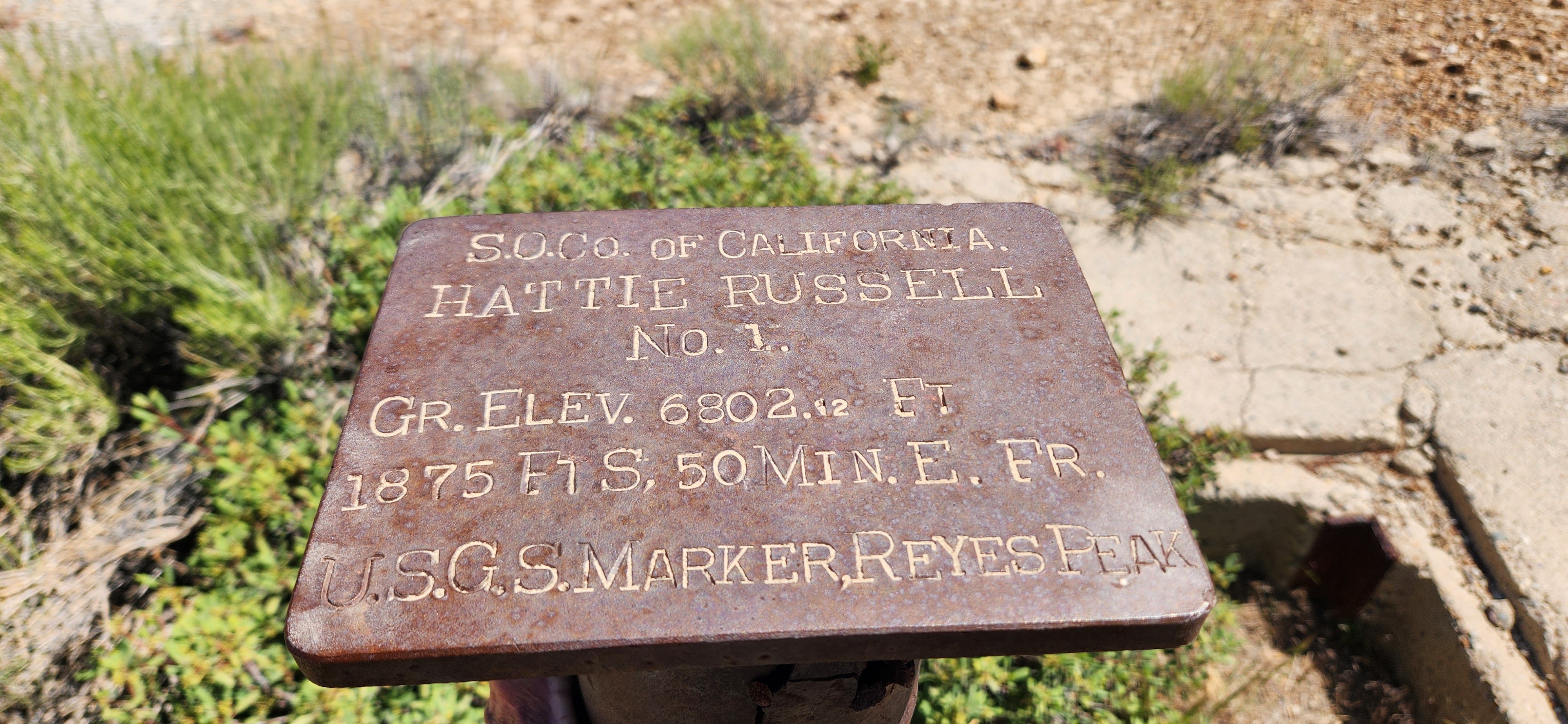
SOCO Hattie Russell #1 well plaque.