


Deep Canyon Geo-hike
January 17, 2025

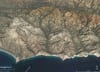
We did a Geo-hike in Deep Canyon, Santa Rosa Mtns, on Friday afternoon 1/17. It's a spectacular canyon with near vertical walls rising +1500 ft from the bottom. Much of the trail is washed out with lots of boulder hopping required. We turned around at an isolated California Fan Palm that has managed to survive frequent debris flows. Its lower trunk shows the wear and tear from flows. Our route was in the Palm Canyon Metamorphic Complex, consisting of well-banded, gneiss, schist, calc-silcate rocks, and marble. The Complex is deformed by a series of map-scale anticlines and synclines with numerous out crop scale folds mimicking the larger folds.
We did a Geo-hike along Coyote Canyon on January 18, 2025. Coyote Canyon follows the Coyote Canyon detachment fault. Exposures of the principal displacement surface and surrounding shear zone are excellent. Canyon is one of the best locations in California to observe and track for some distance, a very low-angle-extensional fault, aka detachment fault. Hike is about 6.0 miles roundtrip and involves scrambling up several dry waterfalls that are challenging but not too risky. The fault continues into the north fork of Bear Canyon, where a fault scarp is present along the fault trace. Scarp is the result of geologically recent, but prehistoric, surface rupture from a large earthquake. Oddly, the upside of the scarp is on the hangwall block.
I still look forward to taking a geo-hike with you at Wallace Creek in the Carrizo Plain. http://ceo.scec.org/wallacecreek/directions/ We need to avoid the rainy season, as the roads become muddy and impassible.